Active Norfolk have an online ‘activity finder’ called Every Move Counts. You can view it here.
Cycling in Norfolk
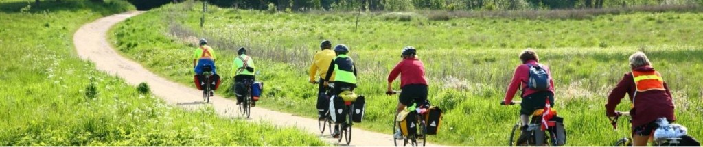
Looking for information about cycling in Norfolk? Cycling UK’s guide to cycling in Norfolk gives you routes, events, clubs and advice to inspire you to cycle in the county.
Norwich – a fine place to cycle round, with a handsome old centre and cathedral area – is about as hectic as it gets round here. Away from the city, Norfolk is a rural county of quiet, picturesque villages, historic churches, big-sky coastlines and the unique watery landscape of the Broads.
There are no mountains to speak – a few hills here and there – but you’re best off with a mountain bike for the 46-mile Peddar’s Way, an almost totally off-road track that follows a Roman Road northwest from Knettishall Heath to Holme-next-the-Sea via pleasant Castle Acre.
There are a couple of railtrails – NCN1 north out of Norwich (part of the 26-mile Marriott’s Way loop), or up from Kings Lynn, for instance – but essentially cycle-touring here means roads. Not that there’s too much traffic away on the country lanes, though. The Norfolk Coast Cycleway is a 92-mile network of quiet roads that tracks NCN1 and NCN30 from Kings Lynn to Cromer and Great Yarmouth, with lovely views of the coastline and countryside.
En route you pass Happisburgh, known for its eroding coastline. Much of Norfolk’s cycle-touring charm comes from the lovely villages and towns you pass through, some of the most picturesque being Blakeney, Cley, Burnham Market, Holkham with its estate and nature reserve, and the pilgrimage village of Walsingham.
The Broads are arguably best explored by boat, but there are many bike trails through it. A quirky cycling experience is the tiny chain ferry at Reedham, the only crossing of the Yare for miles (so check it’s working before cycling the long cul-de-sac to get there).
Find out more including local groups: https://www.cyclinguk.org/cycle/cycling-norfolk
Norfolk cycling events: https://www.norfolkcyclingevents.co.uk/
Norfolk County Council: https://www.norfolk.gov.uk/roads-and-transport/alternative-ways-to-travel/cycling
Health and Wellbeing Walks
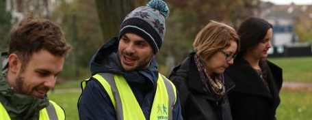
Walking has been described as the perfect exercise, and we completely agree! Hover over the images below and click the links to find out how walking can help everyone live happier, healthier lives.


Walking works report
Walking works, and we have the proof! Our extensive overview of the mounting research into the life threatening consequences of inactivity, which concludes that walking is the answer. Supported by Public Health England, this report demonstrates walking is the solution to getting the nation active, and shows how Walking for Health is already changing people’s lives.
Taverham – Drayton – Costessey + Aylsham & District Health & Wellbeing Walks were formed in April 2016, after government funding was withdrawn from the previous scheme. Ray Watkins ( who sadly passed away in May 2020) was determined to keep the walks going, and with help from Peter Neave & Jeremy Osborne (who set up the webpage) T.D.C. + A. & D. Health & Wellbeing Walks were formed. All walks are run by Trained Walk Leaders, who are all unpaid Volunteers & are free.
Find out more:-
Central Norfolk Walking for health
Taverham, Drayton, Costessey, Aylsham and District Health and Wellbeing Walks
Go Geronimo Health Walks- Great Yarmouth

Countryside Access in Norfolk: Public Rights of Way, Trails. Permissive Paths

Norfolk is blessed with 2,400 miles of Public Rights of Way, giving us all the right in law to get out and enjoy the fantastic landscape that the county has to offer.
Public Rights of Way (PRoW) consist of public footpaths, bridleways, restricted by-ways and by-ways open to all traffic. This link takes you to a definitive interactive map of Norfolk’s Public Rights of Way network Norfolk Highways and Public Rights of Way
The PRoW fall under the statutory duty of Norfolk County Council and are managed by the Countryside Access team within the Highways Department.
‘Norfolk County Council has a duty to assert, protect and keep open any public right of way and to make and preserve maps and other records of the rights of way in its area. The council must enforce the public’s common law rights of passage and investigate and record where those rights exist.’
If you have any issues about footpaths that need addressing, the most effective way to contact the team is through the NCC website where you can register your problem Report a problem – Norfolk County Council. The team monitors the reports and triages them accordingly. Issues of health and safety on busier routes are addressed as a priority.
Trails
Alongside this PRoW network is also a network of long-distance trails and associated circular walks. There trails are managed by the Trails team based in the Environment Department and they focus on upgrading and maintaining 10 Norfolk Trails and 2 National Trails (Coast Path and Peddars Way) and the associated circular walks.
The trails run across PRoW and quiet country lanes and are an exciting way to explore iconic areas of the county.
To find out more and start your exploration, dig deep into the vast amount of information in the NCC website and start planning your next adventure: Norfolk Trails walking, cycling and horseriding – Norfolk County Council
There is also an excellent interactive map to help you locate where the walks are on the ground: Norfolk Trails Interactive Map – Norfolk County Council
Again if you find any issues you want to report out on one of the trails, the best way to get in contact the team s via this form on the website Report a problem – Norfolk County Council
What’s New for 2022?
The Norfolk Trails network is always expanding and providing even more opportunities for people to get out and explore. The aim of these new trails is to open up less visited parts of the county and to provide an attractive alternative to the busy honey pot sites of North Norfolk.
Kett’s Country Long Distance Trail
At the end of March 2022, Kett’s Country Long Distance Trail is opening. An 18-mile linear walk with 5 circular walks which will lead walkers through an ancient, farmed landscape that has echoes of historic unrest. Starting in Wymondham, the birthplace of Robert Kett, unlikely leader of Kett’s Uprising in 1549, it winds across this nature-rich, tranquil part of South Norfolk, and eventually ends just beyond Cringleford Bridge, the exact place where Kett and thousands of poor country folk crossed the river on route to Norwich, demanding that the rich landowners gave them their common land back. Historic common land was being enclosed so that landowners could graze sheep and turn a higher profit.
Kett’s Rebellion was all about the struggle for social justice and fair access to the natural world, but the Tudor state was ruthless, and the rebellion was crushed and Robert Kett hung as traitor.
Walking this new trail is a chance for us to reconnect with this magical landscape and to reconnect with our forebearers who put up a doomed fight to keep it open. Kett’s Country (Norwich to Wymondham) – Norfolk County Council
Bure Valley Path
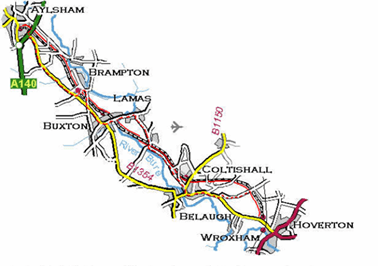
In the summer of 2022, the upgraded route from Aylsham to Hoveton will be opened along the side of the popular Bure Valley Railway.
This new path will have great access for all and will showcase iconic heritage features, interpretation and nature themed itineraries.
Jubilee Trails
Keep your eye on our website for news about 4 new Jubilee Trails around the county in honour of the Queen’s Platinum Jubilee Out and about in Norfolk walking and cycling – Norfolk County Council
Outdoor Swimming
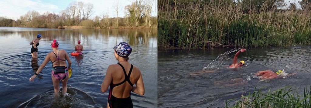
Outdoor swimming (sometimes called wild swimming), done safely and responsibly, is an affordable and fun activity accessible to almost all and with great benefits to health, well-being and appreciation of nature and the environment. There can be risks, but there is plenty of information on how to stay safe, where to go, and how to find others to swim with.
The Outdoor Swimmers Code outlines ways that swimmers can respect the environment, take responsibility for their own safety, and be considerate of other water users and local communities.
The Outdoor Swimming Society has information on a wide range of safety issues for swimming, and there are other sources of safety info.
In Norfolk, the Brecks (and around the country) there are numerous informal swim groups, usually on social media, which enable outdoor swimmers to meet others and share experience, and some give information on safety and places to go.
A national heritage lottery funded project in the Brecks, Healing Waters (Outdoor Swimming), is running some introduction to outdoor swimming sessions, and promoting safety and access in the area.
There are few organised and supervised venues or activities in the area, generally in the summer months and mostly through triathlon clubs or lidos in neighbouring counties.
More information:
Outdoor Swimming Society’s Outdoor Swimmers Code
Outdoor Swimming Society’s safety information, Survive
A Q&A with key info on swimming and playing in water safely
Healing Waters (Outdoor Swimming) project
Triharder, Tri-Anglia, or King’s Lynn Tri.
Naturally in Norfolk

Wanting to get out and about and explore our beautiful county? Not sure where to start? Naturally in Norfolk exhibits different walks and natural spaces within Norfolk.
All information you need for walks, such as postcodes and facilities, can be found in one place. Making it easier for you to decide if the walk is for you.
Walk recommendations are very much welcome!
To find the perfect walk for you, follow the links below:
Website: https://naturallyinnorfolk.wixsite.com/mysite
Instagram: https://www.instagram.com/naturallyinnorfolk/
Facebook: https://www.facebook.com/NaturallyinNorfolk

